Resource description:
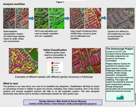
The accurate identification of greenspace typologies enables assessment of the contribution that urban greenspaces make to biodiversity, improving peoples well-being and the green economy, a focus of the EU FP7 project GREENSURGE. It has been shown that the conventional pixel by pixel classifications often cannot obtain satisfactory results especially in complex urban environments and are not able to account for
meaningful image objects at different scales. Using remote sensing data and an object rather than pixel based approach allows a more meaningful, accurate and automated approach to classification based on the objects spatial and spectral properties.
The aim was to develop a method using object-based image analysis to assess garden structures including trees, shrubs and grass in a case study area (Edinburgh). The resulting identification and classification of garden types will be combined with biodiversity data to create a biodiversity indicator for each garden type or estate within the case study as well as being used to improve land cover information.
Author/Contact:
Shelley Barbour, Forest Research, shelley.barbour@forestry.gsi.gov.uk
Partners:
Mike Smith & Darren Moseley
Licence:
- Free, no licence
Development stage:
- Full, working product
- frobiaertposter.pdf (2 MB)