Image:

Resource description:
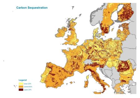
This dataset contains maps of supply and demand of a few ecosystem services, and GIS tools to make such maps. The tools are targeted at EU level and provide a broad picture of ES supply and demand. Tools are moderate complexity methods for mapping, that upscale findings from detailed process based models to EU scale, based on land use and biophysical characteristics.
Author/Contact:
Nynke Schulp, Vrije Universiteit Amsterdam
Assistant Professor Environmental Geography group
Publication date:
Requirements:
- ArcGIS with Spatial Analyst and ModelBuilder
- Alternatively: R with raster packages.
Advantages:
- Large-scale overview
- Relatively low data requirement
- Suitable for assessing impact of EU policy options
Constraints:
- Not to be used at local scale
DOI reference:
10.1016/j.ecolind.2013.07.014
10.1016/j.ecolecon.2014.06.018
10.1371/journal.pone.0109643
10.1111/gcb.13191
10.1016/j.apgeog.2015.06.009
10.1016/j.landusepol.2016.05.018
Licence:
- Free, no licence
Development stage:
- Full, working product
Resource link: