Image:

Resource description:
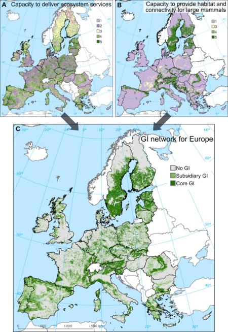
A methodology that can be used to identify and map GI elements at landscape level based on the notions of ecological connectivity, multi-functionality of ecosystems and maximisation of benefits both for humans and for natural conservation.
Author/Contact:
Camino Liquete
European Commission, Joint Research Centre (JRC), Institute for Environment and Sustainability (IES), Water Resources Unit, Via Enrico Fermi 2749, 21027 Ispra, VA, Italy
Publication date:
Requirements:
- Identifying, promoting and preserving a strategically planned green infrastructure (GI) network can provide ecological, economic and social benefits. It has also become a priority for the planning and decision-making process in sectors such as conservatio
Advantages:
- The method is applied in a continental scale analysis covering the EU-27 territory, taking into account the delivery of eight regulating and maintenance ecosystem services and the requirements of large mammals' populations.
- The best performing areas for ecosystem services and/or natural habitat provision cover 23% of Europe and are classified as the core GI network. Another 16% of the study area with relatively good ecological performance is classified as the subsidiary GI n
Constraints:
- N/A
DOI reference:
10.1016/j.envsci.2015.07.009
Licence:
- Public/open source
Development stage:
- Full, working product