

Resource description:
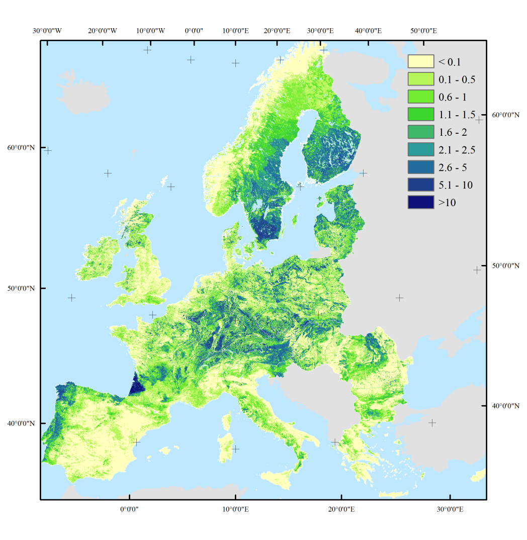
The European Forest Institute, in cooperation with Humboldt-Universitat zu Berlin and VU University Amsterdam, developed a set of high-resolution wood production maps for European forests. The maps contain predicted volumes of wood production, based on statistics collected for 29 European countries from 2000 to 2010. The maps were created by disaggregating statistics from 460 administrative regions to 1x1 km raster maps based on a set of location factors (including productivity, tree species composition and terrain ruggedness), which were identified through regression modelling. The maps were validated and verified using forest inventory plot data and detailed wood production statistics for various regions across Europe.
Author/Contact:
Hans Verkerk (hans.verkerk @ efi.int)
Images

Requirements:
- NA
Advantages:
- The wood production maps give insight into forest ecosystem service provisioning and can be used to improve the assessment of potentials and costs of woody biomass supply.
Constraints:
- NA
DOI reference:
http://dx.doi.org/10.5061/dryad.mk067
Licence:
- Public/open source
Development stage:
- Full, working product