Resource description:
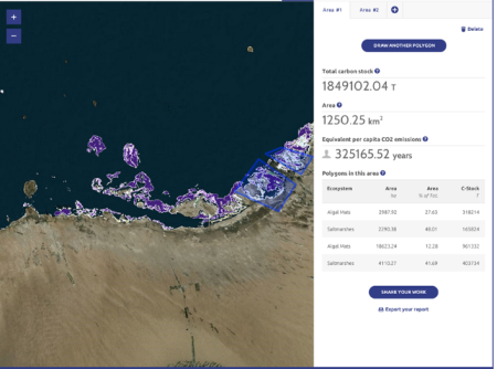
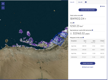
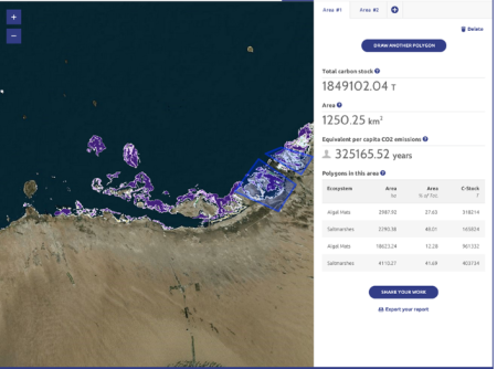
The Blue Carbon Toolkit integrates both online and offline (tablet-based) technology for assessing and validating coastal 'blue carbon' habitats (mangroves, saltmarsh, seagrass etc). The tool allows habitat validations to be completed in the field using an offline, tablet-based validation tool and provides a user friendly interface to capture relevant metadata. The online assessment tool allows users to create "areas of interest" on satellite maps and receive information on the habitat extent and associated carbon stored in the vegetation and soil. The online validation tool is the administrative, back end of the Toolkit which allows project managers to accept, modify or reject changes.
Author/Contact:
Images
Requirements:
- Habitat data in a GIS format.
- Blue carbon data (desirable not essential).
Advantages:
- Very simple interface and minimal data requirements.
- Can be used in the field via tablets and phones.
- Allows data to be summarised in a very intuitive manner and provides clear information to end users.
Constraints:
- At present the tool can only be used in specific, pre-defined, geographic locations.
- At present the tool is set up to record specific information, however, this can be modified.
- At present the field based part of the tool only works with Apple products.
Additional information:
The tool has been developed and used for two projects and as such is limited to the wishes of the clients. The ambition is to develop the tool and make it more widely available and we welcome enquires from interested users.
Development stage:
- Early access - alpha phase

