
Resource description:
Among the tools developed in the scope of Nature4Cities, one is dedicated to the assessment of noise.
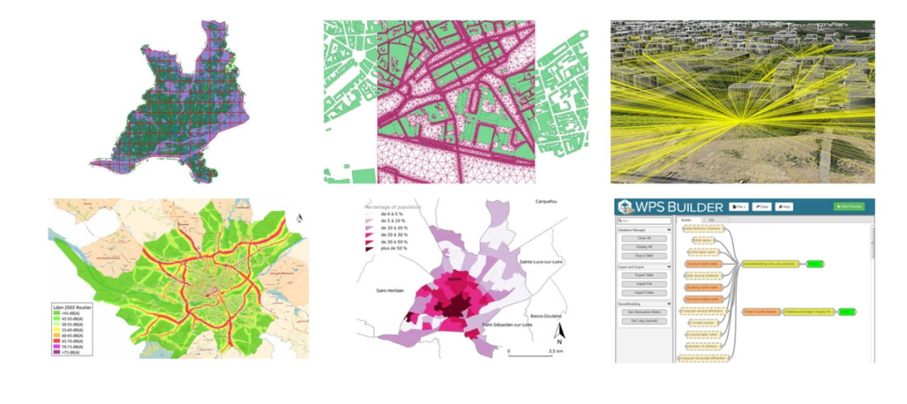
NoiseModelling is a free and open-source tool designed to produce environmental noise maps on very large urban areas. Urban planners can use NoiseModelling in order to carry out impact studies of new urban (or even peri-urban) devices, now including nature based solutions (e.g. vegetalized facades).
Images
Additional information:
This tool can be used as a Java library or be controlled through a user friendly web interface. It is closely paired with spatial database H2GIS or PostGIS in order to handle a large amount of spatial features. In addition to the operational aspect, this tool is an excellent support for training, teaching and research.
This tool, comprising a calculation method and a Human Machine Interface (HMI) software, will be especially useful to sound design engineers and students in environmental acoustics.
NoiseModelling requires the following input data: land cover use, built-up information, road positions, road traffic data, etc.
The calculation (emission + propagation) is then carried out through the EU-CNOSSOS method (validated and included in the Noisemodelling tool).
The user then gets noise maps of reglementary sound indicators (Lden), for a sound source of concerned (e.g. road traffic noise emission).
Moreover, NoiseModelling can be also used for other applications and output data, i.e. histograms of sound levels at different periods and for different 1/3rd octave bands.
This tool was upgraded in the scope of the project Nature4Cities. This project has received funding from the European Union’s Horizon 2020 research and innovation programme under grant agreement No 730468
Licence:
- Public/open source
Development stage:
- Full, working product