Image: Local Ecological Footprinting Tool (LEFT) LEFT presents a simple yet effective method for mapping ecological important landscapes beyond protected areas. The method uses existing globally ...
Image: Stated preference valuation A family of techniques which use individual respondents statements about their preferences to estimate change in utility associated with a proposed...
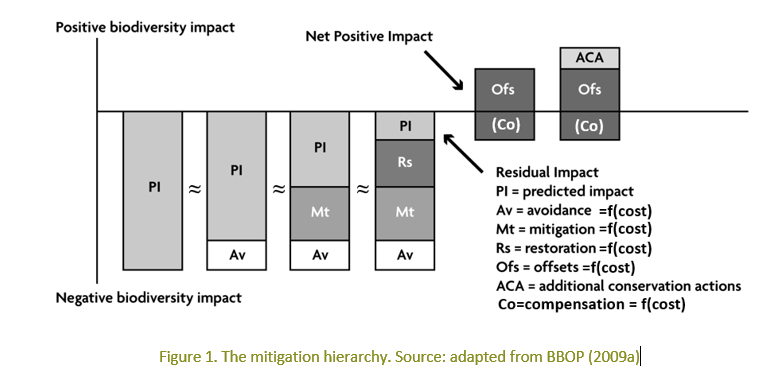
Image: Hedonic property pricing Mitigation cost-based valuation methods are a group of valuation methods that use the cost of actual measures to maintain ecosystem service provisi...
Image: EcoCities: Four Degrees of Preparation Central to research project, EcoCities, is the concept of building adaptive capacity. This concerns helping cities to develop the skills, knowledge...
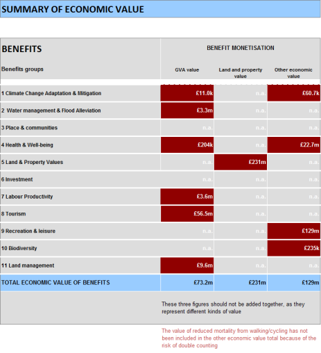
Image: Green Infrastructure Valuation Toolkit A toolkit for valuing the benefits of green infrastructure, consisting of a spreadsheet calculator and a user guide. Monetary and non-monetary valu...
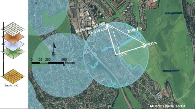
Image: Hedonic property pricing Hedonic pricing is the study of multi-correlation between environmental characteristics of a good and its sales price. The Hedonic property pricing...
Image: Assessment and mapping of ecosystem services - Development of methods for assessment and mapping of ecosystem services of marine and inland waters The general purpose of the project "Development methods for assessment and mapping of ecosystem services of marine and inland waters" is to help st...
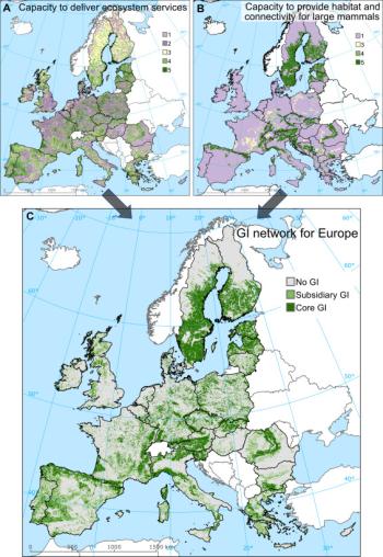
Image: Mapping Green Infrastructure based on ecosystem services and ecological networks: A Pan-European case study A methodology that can be used to identify and map GI elements at landscape level based on the notions of ecological connectivity, multi-functional...
Image: ALARM - Assessing large scale risks for biodiversity with tested methods Based on a better understanding of terrestrial and freshwater biodiversity and ecosystem functioning ALARM will develop and test methods and protoc...
Image: AlpES - Alpine Ecosystem Services The AlpES project's overall objective is to introduce ecosystem services as a regional/transnational environmental governance framework and train a...
Image: Intregrated Biodiversity Management, South Caucasus Together with our partners, we develop strategies to facilitate the sustainable management of biodiversity and ecosystem services across sectoral a...
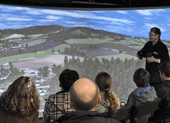
Image: Virtual Landscape Theatre The Virtual Landscape Theatre (VLT) is a mobile curved screen projection facility, in which people can be 'immersed' in computer models of their en...