Image: Nature Positive Recovery "While the most immediate priorities of COVID-19 responses have rightly been health and economic well-being, the crisis has also created a new appr...
Image: Internet of Nature Podcast Can nature and technology long viewed as opposing forces work together to stabilize our climate, sustain our urban environments, and benefit our ...
Image: The economic case for nature The Economic Case for Nature is part of a series of papers by the World Bank that lays out the economic rationale for investing in nature and recog...
Image: From Nature-based Solutions to the Nature-based Economy - Delivering the Green Deal for Europe (Draft White Paper for consultation) Decades of research and more recently public policy recognise that current economic practices are not compatible with a healthy planet. The Europea...
Image: NbS Learning Scenarios Better awareness of the opportunities, benefits and limitations of nature-based solutions has been identified by citizens and experts as one of the...
Image: NbS Learning Scenarios Better awareness of the opportunities, benefits and limitations of nature-based solutions has been identified by citizens and experts as one of the...
Image: Natural Capital & Biodiversity Briefing As the ongoing climate emergency and unbridled human activity continues to have a direct, catastrophic impact on biodiversity, the destruction of h...
Image: Green Cities and Contemporary Climate Planning: Politics and Practices Green cities and green infrastructure have become common planning practices. But why is nature good and how does green matter? Do all people have e...
Image: COVID-19 and its impact on public life and use of public space This episode discusses the impact of COVID-19 on the behavior of people in public spaces in Dortmund (Germany), San Francisco (USA) and Isfahan (Ir...
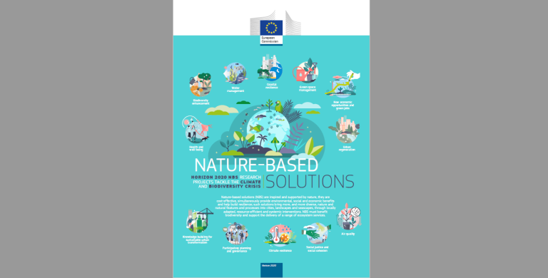
Image: Infographic: Horizon2020 Nature-based Solutions Projects Nature-based solutions (NbS) are inspired and supported by nature, they arecost-effective, simultaneously provide environmental, social and economi...
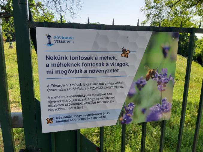
Image: BIODIVERZITÁS: Hogyan váljunk méhbarát kerületté, településsé? A kzztett tudsanyagokat Budapest XII. kerlete, Hegyvidk nkormnyzata ksztette a Mhbart Hlzat tagjaival egyttmkdsben, a BeePathNet nemzetkzi projekt ...
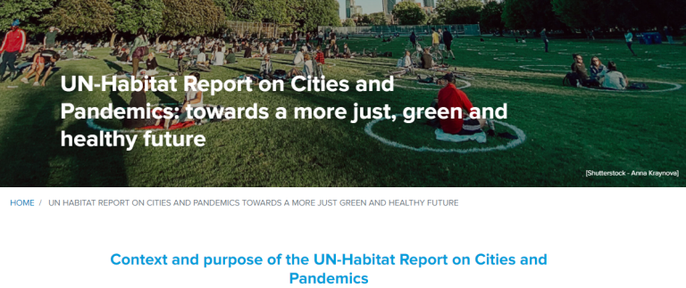
Image: UN-Habitat Report on Cities and Pandemics: towards a more just, green and healthy future The UN-Habitats report - Cities and Pandemics: Towards a more just, green and healthy future evidences how cities can reduce the impact of future ...