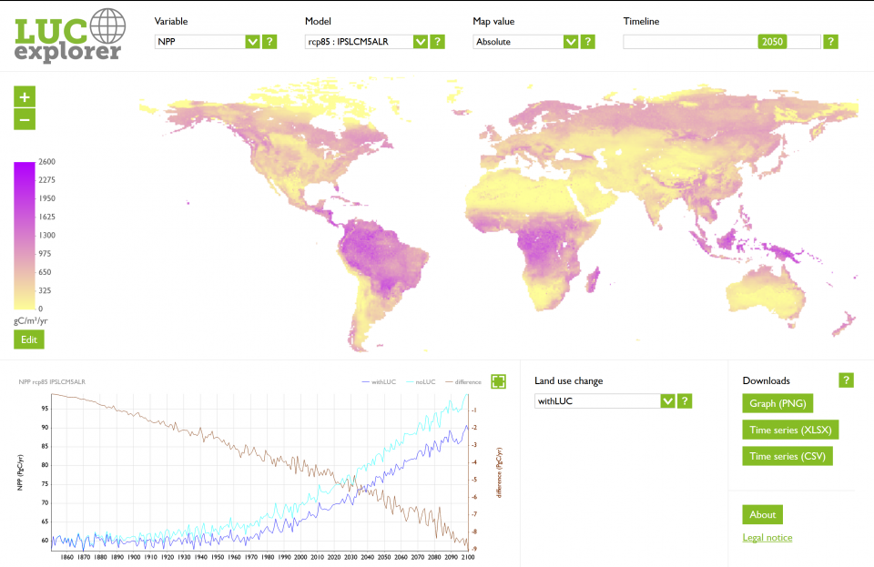
LUCexplorer is an innovative emulator tool that provides information on changes to carbon variables in response to land use change. It provides maps, time series and global and regional averages for variables such as gross primary productivity, leaf area index and carbon stored. Users can choose from existing land use change scenarios or construct their own custom scenarios. LUCexplorer provides fast easy access to model output results and supports learning about modelling and interaction between land use and other variables.
The original concept and underlying data for LUCexplorer (version 1.0) were created by Dr. Benjamin Quesada and Prof. Almut Arneth at Institute of Meteorology and Climate Research - Atmospheric Environmental Research, Karlsruhe Institute of Technology. The user interface design and software development were carried out by Jonathan Porter, Tom Butlin, Ivan Gajos and Mike Shaw of Countryscape, Manchester. The work was carried out as part of the LUC4C project, which received funding from the European Union's Seventh Framework Programme for research, technological development and demonstration under grant agreement number 603542.
The data displayed in LUCexplorer is based on three sets of simulations of the dynamic global vegetation model Lund-Potsdam-Jena General Ecosystem Simulator (LPJ-GUESS) Carbon-Nitrogen version 3.0. LPJ-GUESS is a process-based dynamic vegetation-terrestrial ecosystem model designed for regional or global studies. Given input data on regional climate conditions (temperature, precipitation and incoming solar radiation) and atmospheric carbon dioxide concentrations, it can predict structural, compositional and functional properties of the Earth's terrestrial ecosystems. LPJ-GUESS is very widely used by international researchers. More information is available at the LPJ-GUESS home page at Lund University.
Explore land use change by visiting LUCexplorer
