Image: EPIC WebGIS Portugal EPIC WebGIS is an interactive spatial data infrastructure, which provides georeferenced cartography at a national scale, using data visualization t...
Image: Swiss Biodiversity Forum The Swiss Biodiversity Forum is the scientific competence centre for biodiversity in Switzerland. It aims at supporting the research of biodiversit...
Image: COMDEKS In the long-term, the COMDEKS Country Programme Landscape Strategy for Slovakia aims to increase the resilience of target natural ecosystems and hu...
Image: GIS Training & EcoSpatial E-learning To meet the growing demand for subject-specific and relevant GIS training courses Westcountry Rivers Trust have developed a series of intensive GIS...
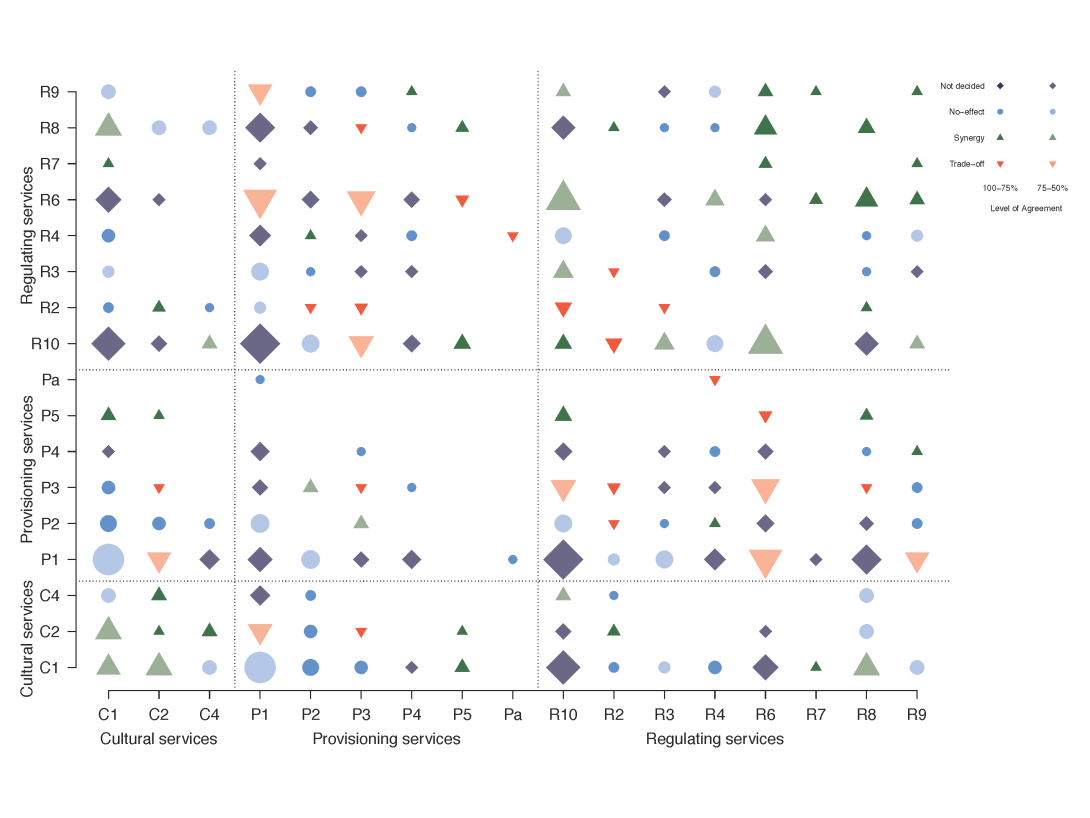
Image: A quantitative review of relationships between ecosystem services These are the figures that are published in "A quantitative review of relationships between ecosystem services" in Ecological Indicators in 2016. I...
Image: Belgium Ecosystem Services Network BEES The Belgium Ecosystem Services (BEES) network is a community of practice, which connects research, practice and policy on ecosystem services and r...
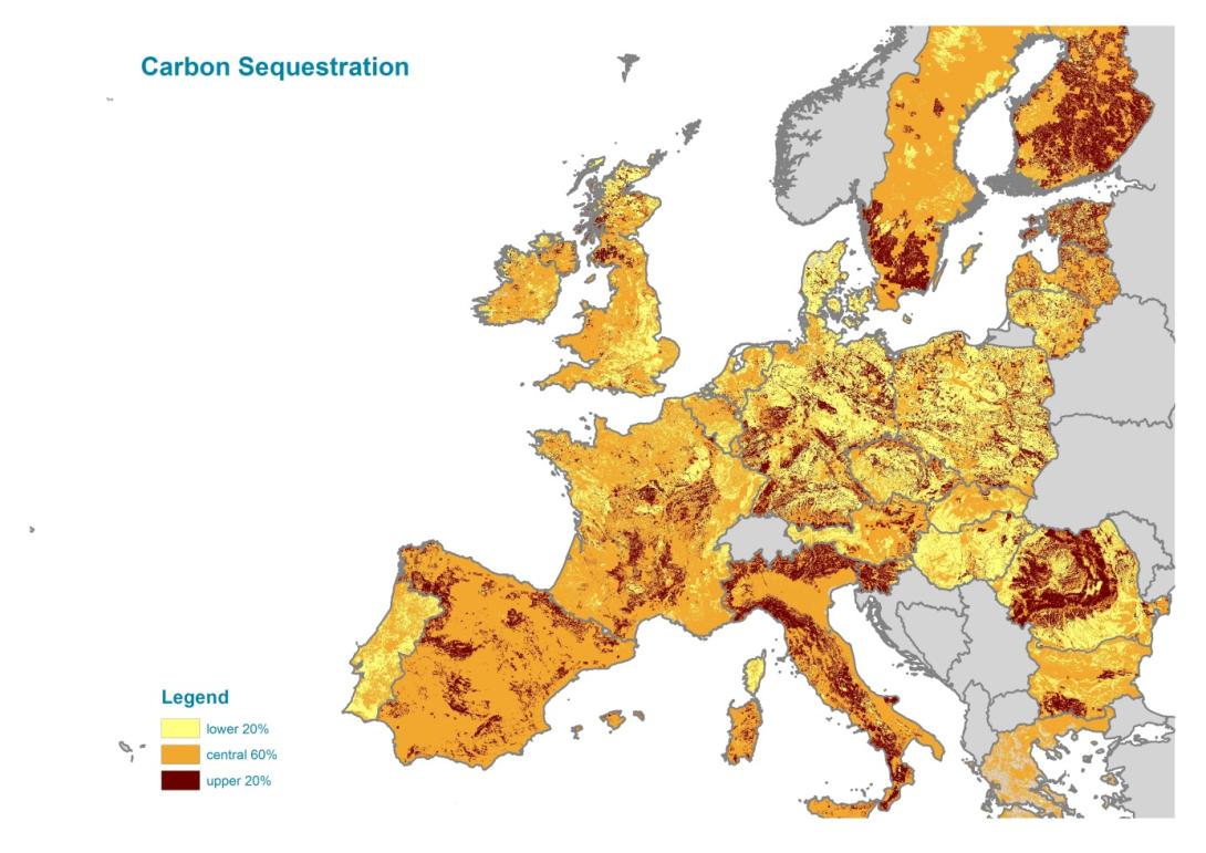
Image: EU level ecosystem services mapping toolbox This dataset contains maps of supply and demand of a few ecosystem services, and GIS tools to make such maps. The tools are targeted at EU level an...
Image: The Ecoregions of Italy In Italy, ecoregion classification, based on detailed scientific data, represents a framework that is used to effectively address national strategi...
Image: Mapping and assessment of ecosystem services in Natura 2000 sites of the Niraj - Tarnava Mica region The goal of the project is to assess and map the most important ecosystem services of the area based on the perception, valuation and utilization o...
Image: The Copenhagen global avian distributional database Distributional data for more than 10 000 species of birds for all land and non-pelagic species was mapped for each species at a resolution of 1x1 l...