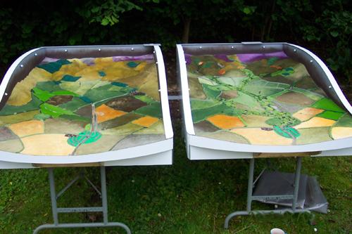
Image: Tweed Forum Catchment Model The Catchment Model recreates two river catchments in miniature - one catchment featuring various natural flood management (NFM) measures and anoth...
Image: EPIC WebGIS Portugal EPIC WebGIS is an interactive spatial data infrastructure, which provides georeferenced cartography at a national scale, using data visualization t...
Image: Swiss Biodiversity Forum The Swiss Biodiversity Forum is the scientific competence centre for biodiversity in Switzerland. It aims at supporting the research of biodiversit...
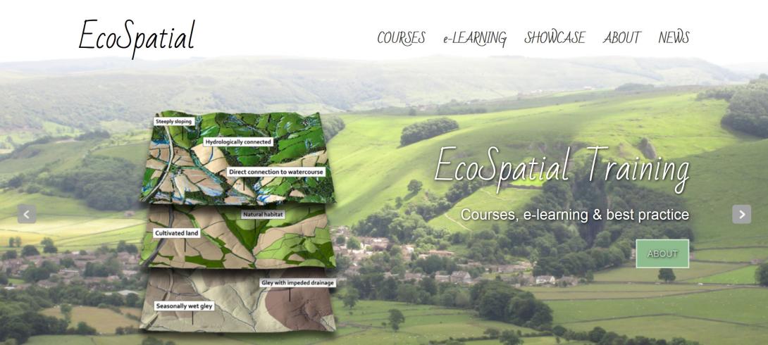
Image: GIS Training & EcoSpatial E-learning To meet the growing demand for subject-specific and relevant GIS training courses Westcountry Rivers Trust have developed a series of intensive GIS...
Image: COMDEKS In the long-term, the COMDEKS Country Programme Landscape Strategy for Slovakia aims to increase the resilience of target natural ecosystems and hu...
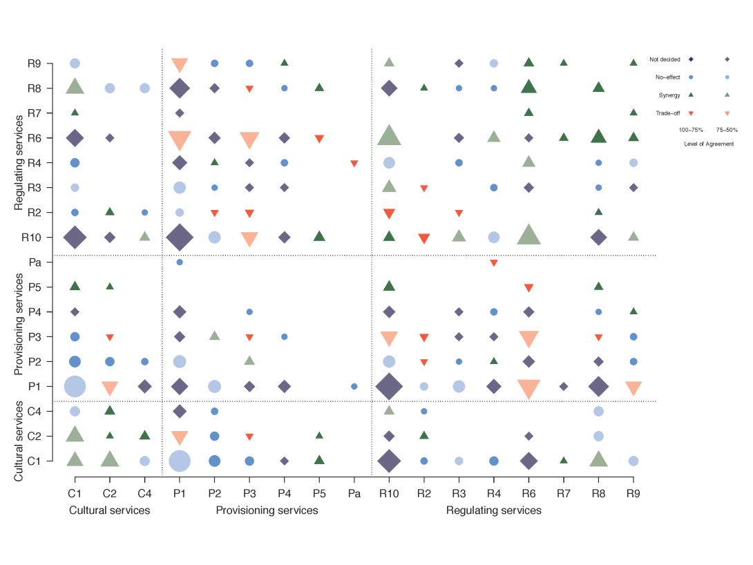
Image: A quantitative review of relationships between ecosystem services These are the figures that are published in "A quantitative review of relationships between ecosystem services" in Ecological Indicators in 2016. I...
Image: Belgium Ecosystem Services Network BEES The Belgium Ecosystem Services (BEES) network is a community of practice, which connects research, practice and policy on ecosystem services and r...
Image: Ecosystem Services Mapping - Oppla Webinar video This webinar was the first of two sessions in a series, beginning the topic of ecosystem services mapping. Nynke Schulp spoke about the reliability...
Image: European Long-Term Ecosystem and Socio-Ecological Research Infrastructure (eLTER H2020) The overall aim of the eLTER project is to advance the European network of Long-Term Ecosystem Research sites and socio-ecological research platfor...
Image: REstoring rivers FOR effective catchment Management (REFORM) REFORM (REstoring rivers FOR effective catchment Management, http://reformrivers.eu/) brought together 26 renowned research institutes and applied ...