
- Report
Taking Action for Urban Nature - Innovation Pathways Directory
What are the enabling conditions and driving forces for nature-based solutions in the context of urban sustainability transitions? And how do innovation pathways play a role for nature-based solutions? Innovation pathways are a journey: from the initial idea and its demonstration, to its broader

- Dataset
EPIC WebGIS Portugal
EPIC WebGIS is an interactive spatial data infrastructure, which provides georeferenced cartography at a national scale, using data visualization tools.

- Software
Ecometrica Platform
The Ecometrica Platform brings together sustainability, environment, risk and business management with geospatial intelligence and mapping applications to allow businesses, governments and organisations to make smarter decisions and build long-term value. The Platform is arranged into four

- Document
Defining and assessing success in mainstreaming
This background paper draws on reviews of the mainstreaming targets and indicators of selected NBSAPs from countries at different stages of their mainstreaming process, and the approaches to assessing the success of mainstreaming biodiversity and other issues into development. Recommendations are
- Dataset
Georgian Biodiversity Database
This internet resource aims to introduce the world-wide scientific (and not only scientific) community to the biological diversity of Georgia (and, to certain extent, the Caucasus ecoregion).
- Report
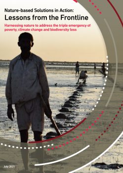
Nature-based Solutions in Action: Lessons from the Frontline
The 13 case studies in this report have been contributed by environment, development and local community organisations. They show NbS in action in a wide range of contexts, from a Farmers’ Seed Network in China that supports agroecology by conserving traditional seeds, to large-scale watershed

- Guidance
- Software
LANDPREF - Interactive tool to assess and visualise land use preferences
LANDPREF is a novel tool to assess desired land use visions. It enables the adjustment of a virtual landscape according to personal preferences of competing land uses, and is an interactive tool for the survey-based assessment of land use preferences. It allows the respondents to interactively

- Document
- Guidance
The Common Agricultural Policy can strengthen biodiversity and ecosystem services by diversifying agricultural landscapes
“The Common Agricultural Policy can strengthen biodiversity and ecosystem services by diversifying agricultural landscapes” is based on the combined results of the FARMLAND, APPEAL, CONNECT, EC21C and ECODEAL projects, funded by BiodivERsA and FACCE-JPI. This 4-page brief presents key

- Document
- Guidance
Urban resilience and sustainability - URBES Factsheet #5
This factsheet explains the importance of understanding the relationship between people and nature in urban planning and decision making in order to achieve urban resilience and sustainability.
- Paper
Providing contact with nature for young generation - A case study of preschools in the City of Poznań, Poland
Contact with nature is valuable for the health, wellbeing and development of children. Meanwhile, the urban environment and the contemporary urban lifestyle limit the opportunity for contact with nature. Given that children aged three to six years spend a significant amount of time in preschool, we

- Training
Hedonic property pricing
Mitigation cost-based valuation methods are a group of valuation methods that use the cost of actual measures to maintain ecosystem service provision as a proxy for the value of avoiding, mitigating or restoring the loss of services ecosystems provide.

- Document
- Guidance
Green infrastructure within agricultural landscapes strengthens the supply of ecosystem services
The brief on “Green infrastructure within agricultural landscapes strengthens the supply of ecosystem services” presents how the results from the EC21C, FarmLand, ECODEAL, APPEAL, SmallFOREST and CONNECT projects. It provides evidence that increasing landscape diversity through green infrastructure
- Consultancy
- Dataset
- Guidance
NbS Selection Tool
The Urban GreenUP ‘NbS Selection Tool’ has been designed to help local governments choose from the many NbS options in our NbS catalogue. This tool is a decision support tool – it’s designed to give suggestions that may help improve you choose the right NbS for you, based on both your city’s

- Guidance
Guía para la Implementación de SbN en Quito
The application of NbS requires the involvement of a wide range of city agents: the policy makers, NGOs and residents They must be accompanied and involved along the way towards a greener city. We can not afford dispense with all existing local knowledge in our local communities. At the same time,

- Slides
Presentation on Reducing Disaster Risk through Restoration
This powerpoint slide provides a case study on a successful example of nature-based solution applied for disaster risk reduction: the Restoration of the Isar River in Germany. The initiative was implemented under the PHUSICOS project. More information on the case study is also available below.

- Report
Mainstreaming Nature-Based Solutions: Economic Regeneration
This report specifically addresses the mainstreaming of urban nature-based solutions for economic regeneration. We understand economic regeneration to be about the improvement and reinvigoration of urban areas. Nature-based solutions have the potential to encourage economic regeneration through

- Document
- Guidance
- Training
PSS Toolkit
Workshop facilitation toolkit for the generation of business ideas/models linked to product service systems at the scale of urban agglomerations.
- Video
PHUSICOS - Caídas de bloques en Artouste
The hazard at Artouste is caused by rockfalls, both from exposed rock ledges and from loose blocks sitting on the surface of the till on the steep slope. The site is adjacent to the Artouste hydroelectric dam, where the RD-934 road descends from the level of the dam to its base. The slope is steep
- Guidance
GIZ ValuES - Method Profile: Participatory mapping
Contrary to other mapping tools, participatory mapping does not primarily draw on statistics or research data, but on the practical knowledge of people. Participatory mapping visualizes local knowledge and makes it visible to all. There are several participatory mapping tools available. In an
- Document
Transition Towards Sustainable and Liveable Urban Futures – JPI Urban Europe Strategic Research and Innovation Agenda
Strategic Research and Innovation agenda (SRIA) Launched in 2015, the SRIA describes the long-term strategy and programme for JPI Urban Europe’s from 2015 – 2020. The SRIA responds to the urgent need for ambitious, sustained and truly inter- and transdisciplinary research to radically improve
- ‹ previous
- 5 of 42
- next ›